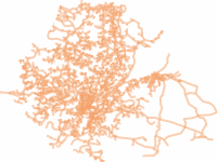
- Thumbnail

- Resource ID
- a31badb4-75aa-11ea-9647-000c2931b24c
- Title
- ETHIOPIA ROAD
- Date
- April 3, 2020, 7:57 a.m., Publication
- Abstract
- data source: ERA
Geographic Coordinate System:GCS_Adindan
Datum: D_Adindan
- Edition
- --
- Owner
- tsegaye
- Point of Contact
- Ayele
- tsegayeayele840@gmail.com
- Purpose
- For COVID_19 Analysis and mapping purpose
- Maintenance Frequency
- None
- Type
- not filled
- Restrictions
- None
- License
- Not Specified
- Language
- eng
- Temporal Extent
- Start
- --
- End
- --
- Supplemental Information
- Geographic Coordinate System: GCS_Adindan
Datum: D_Adindan
- Data Quality
- --
- Extent
-
- long min: 33.232265447397500
- long max: 45.340577933249600
- lat min: 3.526878563569660
- lat max: 14.729984641962300
- Spatial Reference System Identifier
- EPSG:4201
- Keywords
- no keywords
- Category
- Transportation
- Regions
-
Ethiopia
